The Simuku project is the second of Coppermoly’s projects to have a declared resource and continues to be a focus of recent exploration activity.
The tenement (EL2379) covers 122.7 km2 and is located within one hour’s drive from existing infrastructure, including the deep-water port of Kimbe.
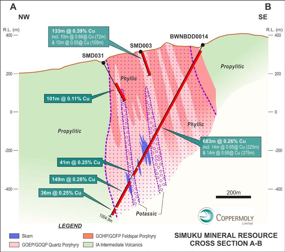
The Simuku deposit consists of a large tonnage, low grade, porphyry style copper mineralisation zone and near surface higher grade secondary copper mineralisation.
The Company has updated the 2009 Mineral Resource, taking into consideration deeper drilling completed between 2009 and 2012 and recent advances in the Company’s geological understanding of the Simuku Project. The Simuku copper-molybdenum-gold Mineral Resource has been updated as 373.6Mt @ 0.31% Cu, 58.5g/t Mo and 0.05g/t Au, at a 0.2% Cu cut-off, and has been classified as Inferred in accordance with the 2012 JORC Code & Guidelines
Simuku Project Inferred Mineral Resource Estimate, 2020
| Category | Mt | Cu % | Au g/t | Ag ppm | Mo ppm | Cut-Off |
| Inferred | 373.6 | 0.31 | 0.05 | 2.1 | 59 | 0.2% Cu |
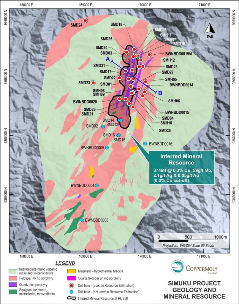
Simuku Geology
Extensive exploration work has been conducted at Simuku since the 2009 resource was defined, with the results providing significant potential for extension of the known mineralised system.
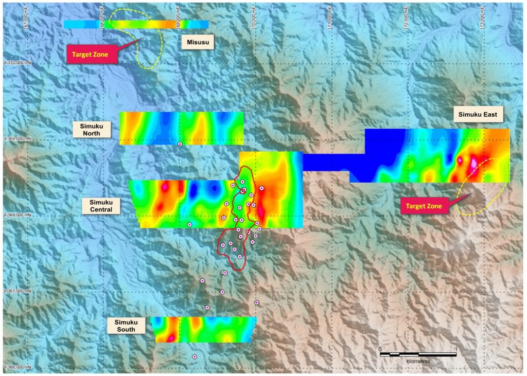
The most recent exploration work has included an extensive air-borne VTEM campaign in 2017, which highlighted multiple anomalies of interest within and outside of currently defined mineralised porphyry-style prospects in the Simuku licence area.
This was followed by an induced polarisation (IP) and resistivity survey in May and June 2019. Interpretation of the IP data suggested that a classic porphyry model fits the Simuku Central mineralised zone and the analysis identified several large volcanic centres as calderas which may host porphyry systems (see figure below).
This interpreted model implies that current known mineralisation at Simuku lies within part of a large circular magnetic feature that is likely to represent a volcanic centre such as a caldera. This caldera feature has a reasonably coherent ring of high magnetic response which associates quite well with high IP chargeability around its margin. The known mineralised zones lie within the magnetic and IP low in the central portions.
This mineralisation model was integrated with geological, geochemistry and geophysical data, identifying two target areas at Simuku East and Misusu that show features of the classic porphyry mineralisation system.
Target Zones Adjacent to the Simuku Mineral Resource